
Quick Facts
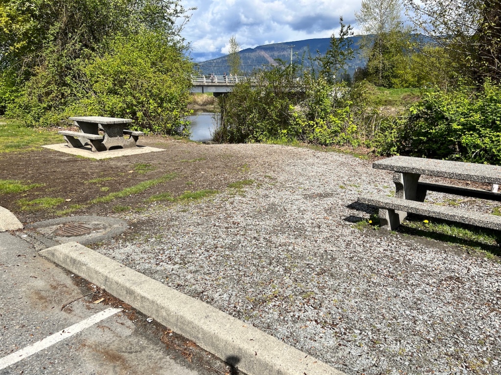
- Parking and Launching: Trail Pavilion, off Harris Road near the bridge
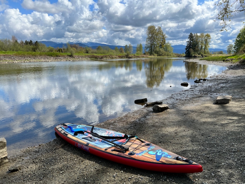
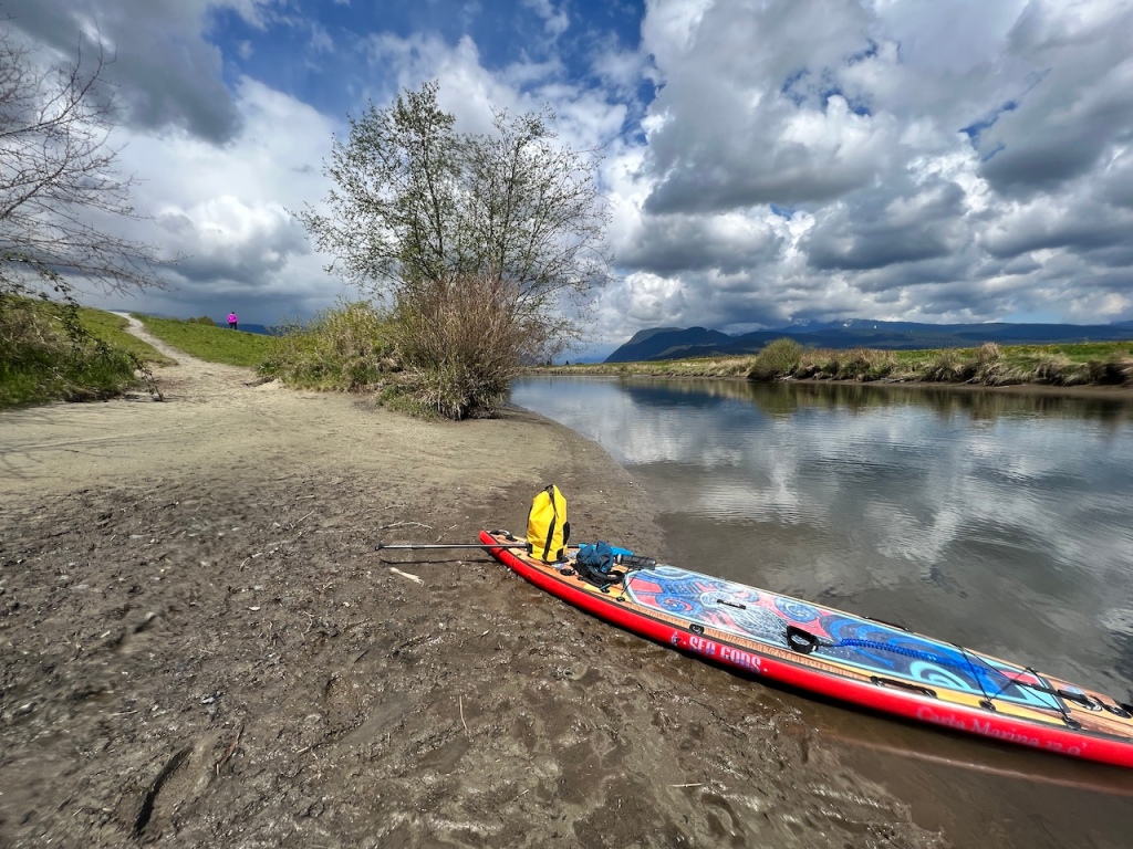
- Launching type: muddy/pebbly beach
- Difficulty – easy, calm river with slow current but variable wind conditions
- Boat traffic – no motor boats east of Harris Road bridge
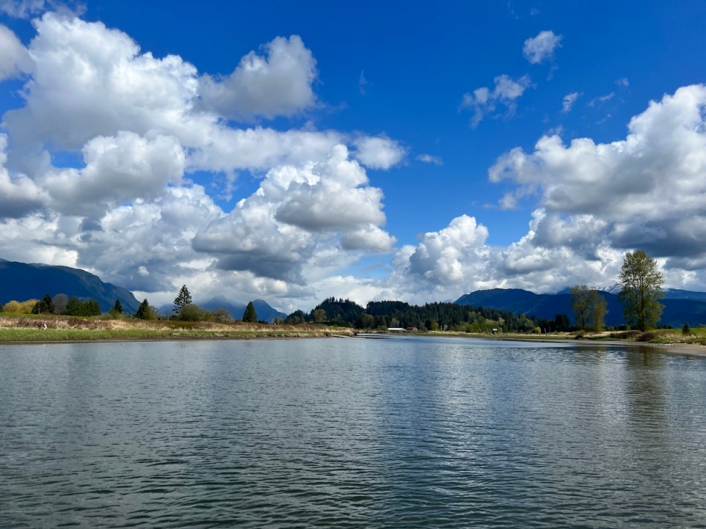
- View – magnificent views of the snow peaks in Golden Ears and Pinecone Burke Provincial Parks when the river points north. Plenty of wildlife viewing opportunities
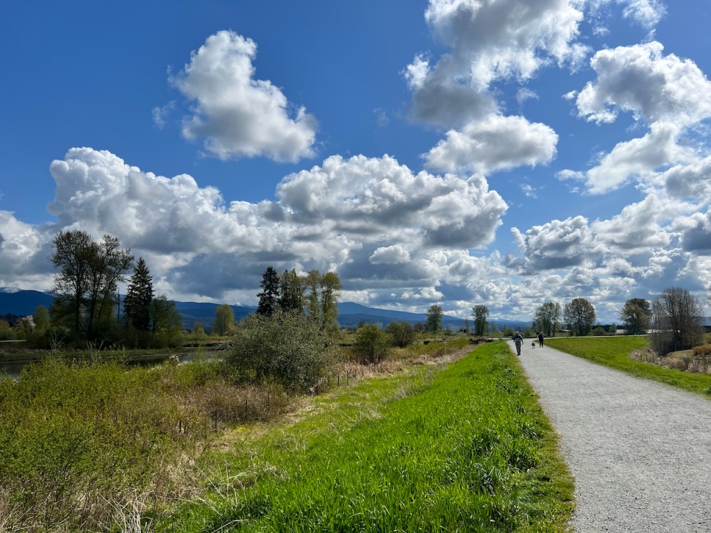
- Facilities – portable toilets at the parking lot. A great network of dyke trails to explore on foot or by biking.
- Overall score – 9/10
Alouette River is a popular paddling destination for some of the best and easiest river conditions around Vancouver. There’s something magical about paddling a meandering river that constantly reveals something new with every turn, be it a new composition of the views, new wildlife to greet, a new navigation decision, a sudden change in the river and wind conditions, etc.
A word of caution regarding river paddling: even though the lower sections of Alouette River is slow and calm, the river is flowing. It is also tidal, and it’s not always easy to check the forecast for tides in this river specifically. The closest approximation is probably tide charts for Pitt Meadows, and assume the river lags behind a bit. There were several submerged trees, with sharp-looking branches that are hidden just beneath the water surface. Bear sighting is reportedly frequent.
Parking at the Harris Road Trail Pavilion parking lot can be busy on a good day especially on the weekends. The area is shared by walkers, bikers, and paddlers, so even though the parking lot was quite large, it can become full at peak hours. I had no trouble finding a spot on this weekday in April.


I launched at 11:30am and paddled upstream.
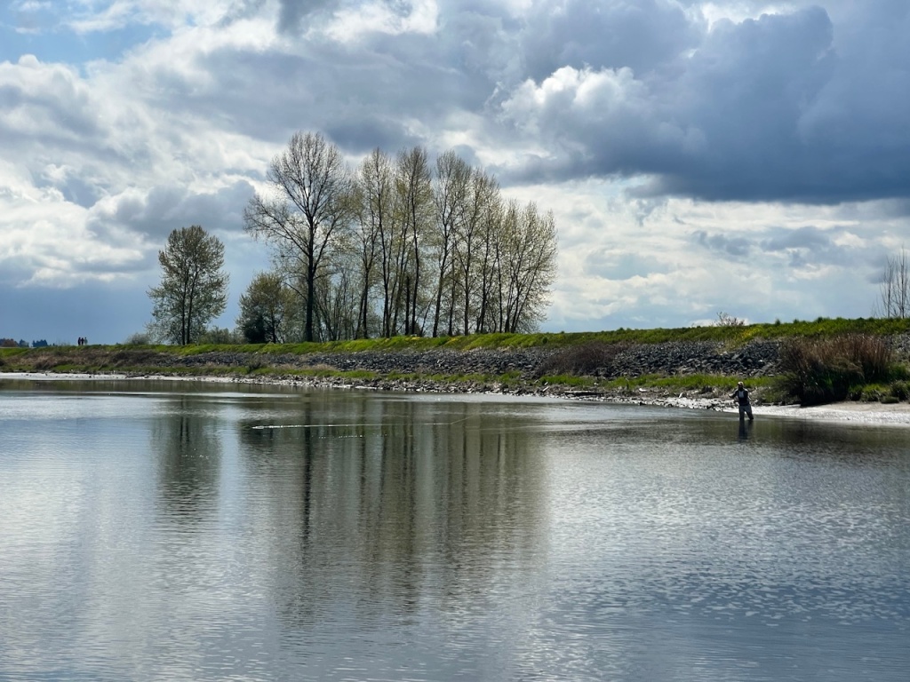
There was a guy practicing fly fishing and doing a pretty good job of it. I didn’t see much fish in the water, and another group of fishermen confirmed that they weren’t having much luck.
The weather was somewhat unsettled, with thick cumulus clouds over the tall mountains, some of which were visibly pouring on Pitt Lake.

25 minutes in, I came upon the fork in the river. The left branch is the North Alouette River, which is shorter but still worth exploring. It actually looked more inviting to go north, with more expansive views of the mountains. Apparently there’s also a closed film set that reportedly can be visible from the water without trespassing. The right branch is the main Alouette River. I took the right and stayed on the main Alouette River for my first outing here.

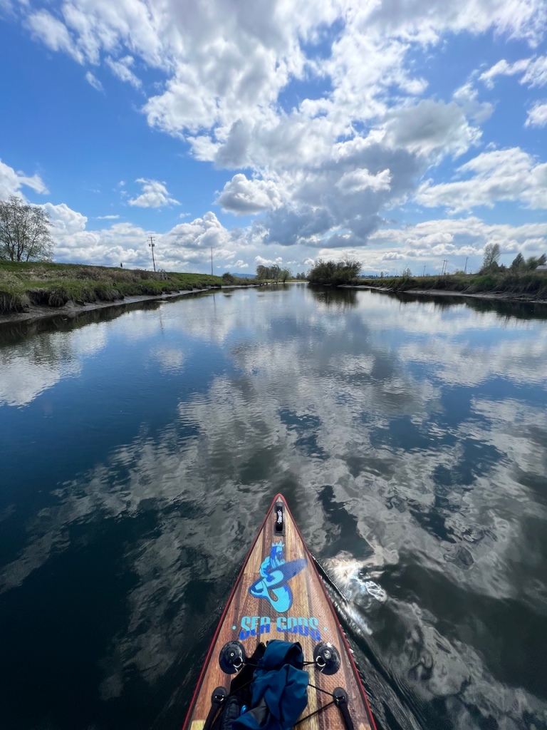
When the wind slowed down, the river was a mirror for the trees and clouds.


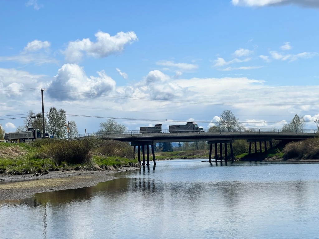
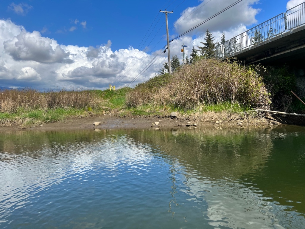
About 1 hour into the paddle, I arrived at Neaves Road bridge. There are some muddy banks near the bridge that reportedly could be used to put in for a paddle, but parking on the road shoulders is limited. Launching from here would be significantly less pleasant than the Harris Road bridge though, given the lack of toilets, parking, and easy access trails.
I continued upstream for another 30 mins, then I had to turn back due to time constraints from my daycare drop-off and pick-up duties. The water current here was noticeably stronger, but it was still quite easy to paddle against it.

The river looks paddle-able further upstream, but the water current can be expected to get stronger. Some kayakers reported that they put in near Horseman’s Park or this location, which is another 3.5km from where I turned around, for a brisk float down river.

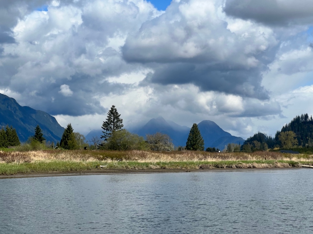
After I turned around, it was a treat to be looking at the spectacular mountains again.

There were only a handful of pull out spots along the river for a stretch. Since the river was quite low, there were many muddy banks to rest too.

I took a breather at one of the pull out spots and hopped onto the dyke trail for a quick look. The views of the mountains are actually significantly better from the dykes. The dykes were just above my eye level (6 feet) when I stood on my paddleboard, so I could only get a good distant view from certain sections of the river when it’s pointing toward the mountains. But it was nice to enjoy the peaceful and quiet exploration of the river even when the mountains weren’t in full view.


After my snack break, the sunny and calm paddle quickly changed. The wind got heavier, which kicked up small chops. A large ominous-looking cloud that was already pouring rain moved in from the south. I pulled up to a muddy river bank and swapped out my fleece jacket for my rain jacket.


I had to paddle against a few bouts of strong headwind, which seemed to be dependent on the turns of the river. When the river flows in the same direction as the wind, the effect was the strongest. I remembered my struggle with this kind of head wind as a beginner paddling back from the nearby Widgeon Creek.

By the time I got back to Harris Road, which took exactly 3 hours including the breaks, the sky cleared again. I had about 30 minutes to spare, so I decided to continue downstream past Harris Road to explore a bit more.
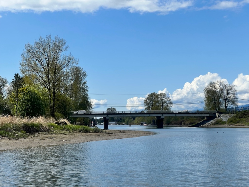
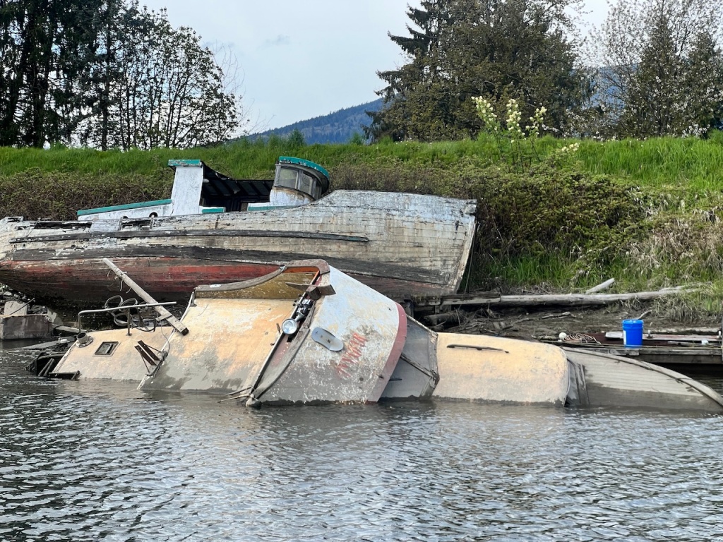
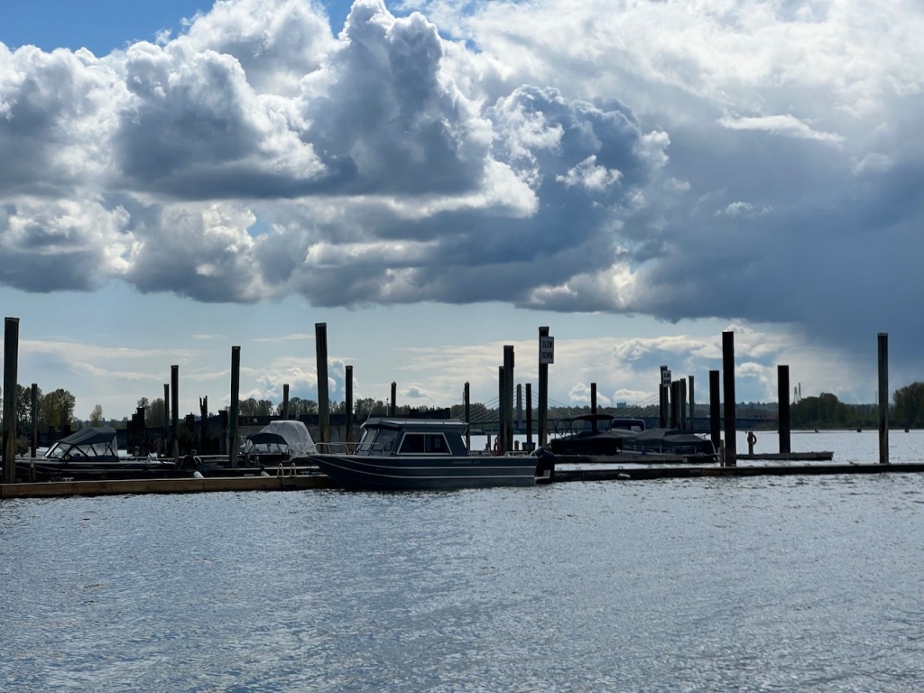
The section of Alouette River west of Harris Road was completely different. The tranquility was replaced with human activity. It housed several boat docks and a small Pitt Meadows Marina at the end, but it was littered with abandoned and half sunken ships, and many of the docks appear to be in need of maintenance.


I got to the mouth of Alouette River and marveled at the formidable Pitt River, which was flowing strongly likely due to spring melt and outgoing tide.

I turned around and got back to Harris Road. Before I re-crossed the bridge, I noticed the no-motor sign. Alouette River upstream from (east of) Harris Road is protected from motor boats.

As a river paddle, Alouette River was definitely among my favorite. It’s much easier to launch and pull out from compared with Widgeon Creek, which contents with fast motorboats and currents in the Pitt River. It’s calmer than River of Golden Dreams. It is quieter and offers better views than Deas Slough and Nicomekl River.
I am planning to come back and explore the North Alouette River. I also want to see how far I can go upstream on Alouette River before I hit an obstacle or when the current becomes too strong. For that, I shall time a rising tide to maximize my chance of success.


One response to “Paddling Alouette River”
[…] Alouette River: another fantastic calm river paddle with no motor boats. May not be suitable for beginners due to the somewhat erratic weather and wind patterns, tidal current, and submerged hazards. […]
LikeLike